By Trish Melander, AG®
Sometimes we reach a point in our research where we just stop finding the family in all the right places; where the expected searches yield no results. Sometimes it’s the decade of time we’re working in, sometimes the records must still be accessed in person at the archive, and in other cases, it’s because we find that we’re working in a border county, a border state, or right next to a big river.
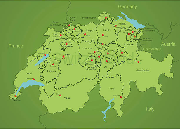
Years ago I traveled to the city of Sion, Switzerland, in the Canton of Valais, to research at the archives there. I was in French-speaking territory, at the Valais State Archives or Archives de l’État du Valais. Looking through the records at the archive helped me to better understand that the area was currently French-speaking, but one of Switzerland’s oldest cities was also impacted by German and Italian languages and historical movements. In Switzerland, there is often an overlap in the languages needed for research, the historical canton boundaries, and the need to open your search more broadly to find those you are seeking. I’ve written here about some of the general techniques you may need to help identify ancestors who lived close to borders, which can make their records more difficult to find and their unique identities a little more elusive. A family in the records of a border town in Canton Valais may also be in France to the west, Italy to the south, or in another Swiss Canton.
Tools to Use
The first two tools that should often be used side by side in research are a gazetteer and a jurisdiction map. When I’m working with U.S. records, I consult the wall map of counties across the entire United States so I can see state borders and bordering counties quickly. Using gazetteers can help us understand many facets of a historical place, including: the size designation (like village vs. metropolitan area), the names of corresponding districts or other levels of jurisdiction, other related places, connections the place may have with ecclesiastical or church boundaries (like parish, diocese, or synagogue), and current naming of the same village. Some gazetteers have their own website, or are scanned through Google Books, FamilySearch Books, or Internet Archive. Jurisdiction maps may be different from common online road atlas maps; seek out a jurisdiction map that shows county and state boundaries for the state or province you are working in.
If you are working in either a library catalog or a large database website (FamilySearch, Ancestry, MyHeritage, etc), most catalogs have a geographical hierarchy. This has been easy to spot in the FamilySearch catalog using the “See” feature at the top of a catalog entry.

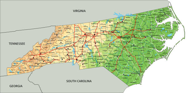
This current example from Onslow County, North Carolina offers more information about Onslow through the “Place Information” link to FamilySearch Standardized Places, information about the higher-level locality using “See: Part of North Carolina” and smaller-level localities using “See: Places within North Carolina, Onslow.” Using this tool to go to larger or smaller localities in the same place (all within North Carolina) can help you better understand which record sets are available for two neighboring localities.
Details to Notice
Pay attention to the type of jurisdictions listed in the record collection. As an example, the decennial censuses for England and Wales use Enumeration Districts, and Town and Township jurisdictions, while continued research on a family from England or Wales often also requires the ecclesiastical jurisdiction (Anglican or non-conformist parish) in order to continue the research. Using a gazetteer and map together can help ensure that the town named in census records and the parish named in church records point to the same family because the boundaries of the two are interchangeable or partially overlapping.
Large elements that are part of the place’s geography may be more of a factor in where the ancestor’s events were recorded than the name of the county or boundaries of the state. Recently, I’ve been working in a Catholic parish in Michoacán (state), Mexico that has a river running through the town. Closer inspection of a map indicates the River Lerma running through town is the boundary line between Michoacán (state) to the south and Jalisco (state) to the north. I observed residents of the town recorded in the parish in Michoacán more than in the parish church in Jalisco, which is more than 35 kilometers to the north, likely because the proximity of the church makes a big difference when it’s time to travel.
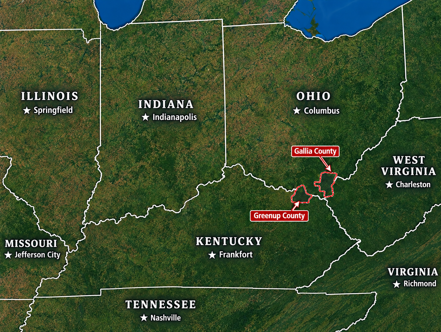
Similarly, a family of farmers went back and forth between Gallia County, Ohio and Greenup County, Kentucky throughout their lives, and it took me quite a while to discover that there were additional records on the family in Greenup County, Kentucky across the Ohio River. Mountain ranges, rivers, swamps, dense forests, small island chains, impassable cliffs, lakes, deserts and other geographical features can all be reasons ancestors would go to a nearer or less hazardous location to register, be married, or declare the death of a relative. When bidding out research projects for clients, it may even be wise to note that it can take additional research time to work on families living in border localities because there may be more than one state’s indexes to search to locate the next set of records.
Final Thoughts
Using detailed timelines and careful source calendaring while researching can help the researcher see gaps in the frequency of a family in the records. While being attentive to avoid the pitfall of grouping together unrelated people of a common surname, reviewing research notes to spot periods of time where no records have been found can often point to travel across borders or land features we may not have initially thought of.
Discover more from ICAPGen℠
Subscribe to get the latest posts sent to your email.

